Hello! I'm Isaac, a Machine Learning Scientist/Engineer at Wherobots with a Ph.D. in Electrical Engineering from the University of Texas at San Antonio (UTSA) advised by Paul Rad. Amongst other things, I train and deploy geospatial AI models for processing terabytes of multispectral aerial and satellite imagery on a cluster of GPUs.I'm passionate about machine learning and computer vision particularly applied to the geospatial and remote sensing imagery domain. I also regularly maintain popular open-source projects like TorchGeo, SMP, and FTW.In a past life, I was involved in developing machine learning solutions for the drone, signal processing, cybersecurity, and biomedical sensor fields as well as updating the embedded software for the U.S. Air Force's A-10 Warthog.I regularly publish open-source country and global-scale prediction maps for a variety of geospatial tasks. See the FTW multi-year country-scale agricultural field boundary predictions here for example.I'm currently available for consultations. If you're interested in collaborating please reach out!
News
Nov 2025
Country-Scale Agricultural Field Boundary Predictions
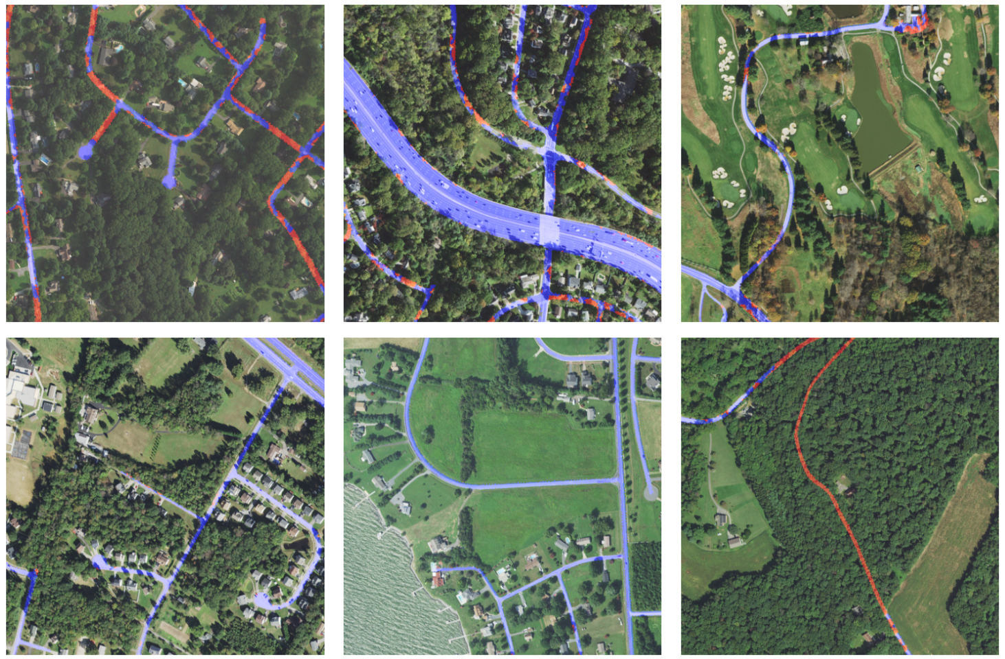
Through my collaboration with Wherobots & Taylor Geospatial Engine, we have open-sourced planting/harvest season mosaics and field boundary predictions for 5 countries for 2023 and 2024.
Oct 2025
Spatial Stack Podcast: Beyond the Hype: Embeddings, Foundation Models, and the Future of Earth Observation
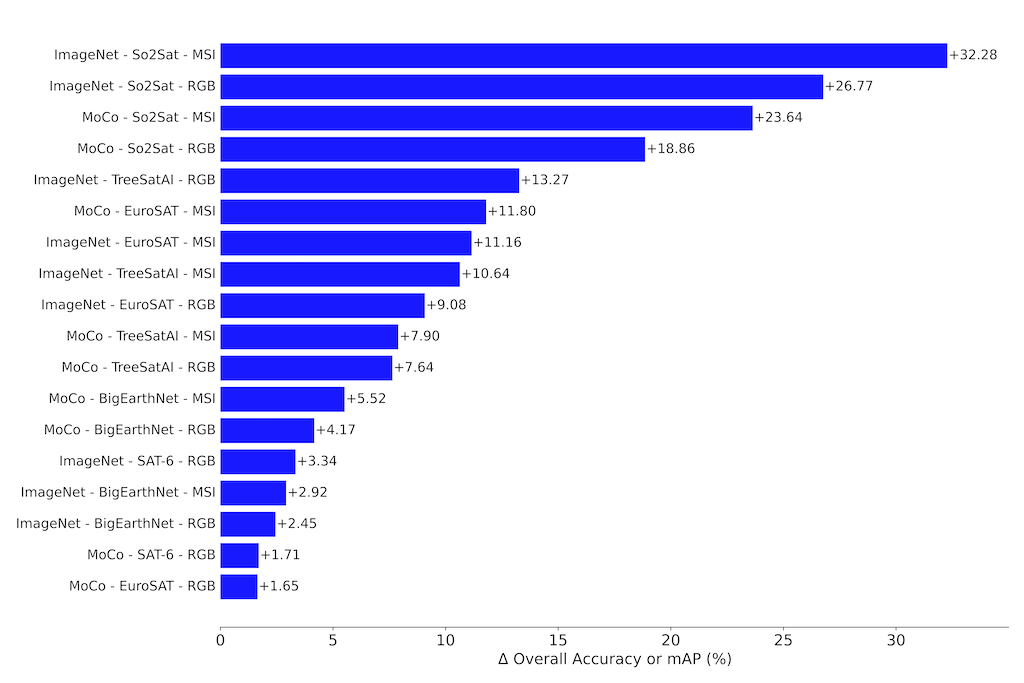
I joined Matt Forrest's Spatial Stack podcast with Chris Ren to discuss the current state of Geospatial Foundation Models and Embeddings.
Aug 2025
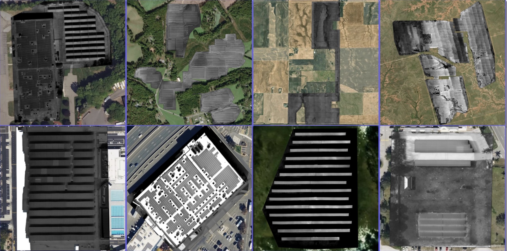
Satellite-Image-Deep-Learning Podcast: Chained Models for High-Res Aerial Solar Fault Detection
I joined Robin Cole's Satellite-Image-Deep-Learning podcast to discuss our CPVR PBVS paper: Aerial Infrared Health Monitoring of Solar Photovoltaic Farms at Scale.
Projects
Selected Publications
ICCV VISION 2025
InspectVLM: Unified in Theory, Unreliable in Practice
Conor Wallace, Isaac Corley, Jonathan Lwowski
CVPR PBVS 2025
Aerial Infrared Health Monitoring of Solar Photovoltaic Farms at Scale
Isaac Corley, Conor Wallace, Sourav Agrawal, Burton Putrah, Jonathan Lwowski

IROS 2024
🏆 Best Application Paper Runner-Up
Barely-Visible Surface Crack Detection for Wind Turbine Sustainability
Sourav Agrawal, Isaac Corley, Conor Wallace, Clovis Vaughn, Jonathan Lwowski
Education
University of Texas at San Antonio
Ph.D. in Electrical Engineering
Advisor: Paul Rad
University of Texas at San Antonio
M.S. in Electrical Engineering
Advisor: Yufei Huang
Texas A&M University - Kingsville
B.S. in Electrical Engineering, Minor in Mathematics
Experience
Senior Machine Learning Engineer — Wherobots
Scaling Geospatial Vision and AI models for the Wherobots platform, which provides real-time geospatial data and insights for various industries.
Senior Machine Learning Scientist — Zeitview (formerly DroneBase)
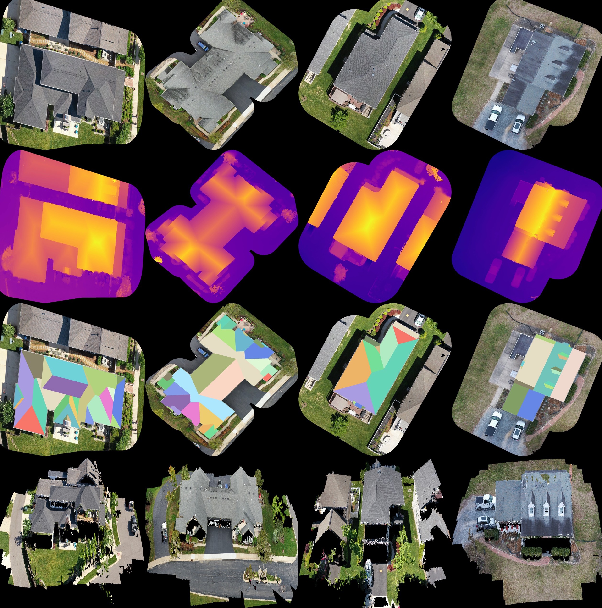
Research, develop, train, and deployed computer vision, vision-language models (VLM), and 3D Reconstruction methods at scale for enhancing renewable energy inspections and analytics, including solar farms, wind turbines, commercial and residential rooftops, transmission and distribution stations, and telecom towers.
Ph.D. Research Intern — Microsoft Research
Advisor: Simone Fobi Nsutezo & Anthony Ortiz
Researched multimodal pretraining methods for large-scale geospatial vision-language datasets.
Senior Machine Learning Engineer — Spruce
Applied state-of-the-art Optical Character Recognition (OCR) and Text Summarization methods to parse real estate and financial documents.
Senior Machine Learning Engineer — BlackSky
Developed and deployed models to drive the Spectra AI platform's satellite image analytics as well as served as the PI on the IARPA SMART program.
Senior Data Scientist — HouseCanary
Developed and deployed computer vision models for extracting insights and features from real estate property images for improving HouseCanary's Automated Valuation Model (AVM) and property recommender system utilized by real estate investors.
Senior Data Scientist — Booz Allen Hamilton
Researched and developed prototypes for deep learning-based image steganography detection and removal as well as adversarial domain generation detection.
Research Engineer — Southwest Research Institute (SwRI)
Advisor: Kenneth Holladay
Developed and deployed software updates to the A-10 Warthog aircraft as well as researched machine learning methods for detecting engine stalls and exploiting the MIL-STD-1553 communications bus.
Research Intern — Oak Ridge National Laboratory (ORNL)
Advisor: Paul Ewing
Recorded and annotated a dataset of seismic signals of human and vehicle activity and trained machine learning methods to detect this activity.